Britain is expected to have an unexpectedly warm end to September, with temperatures reaching 23C.
Forecasts predict warm conditions across the UK into late September and early October.
In the southeast on Tuesday or Wednesday, it could reach highs of 25C.
The average high temperature in London for September 30 is 18C and October 1 is 17C.
While the east and southeast will be warm, Atlantic frontal systems bring spells of rain, showers and occasional strong winds to other parts of the UK.
The wettest and windiest conditions will tend to be most frequent across western areas, according to the Met Office.
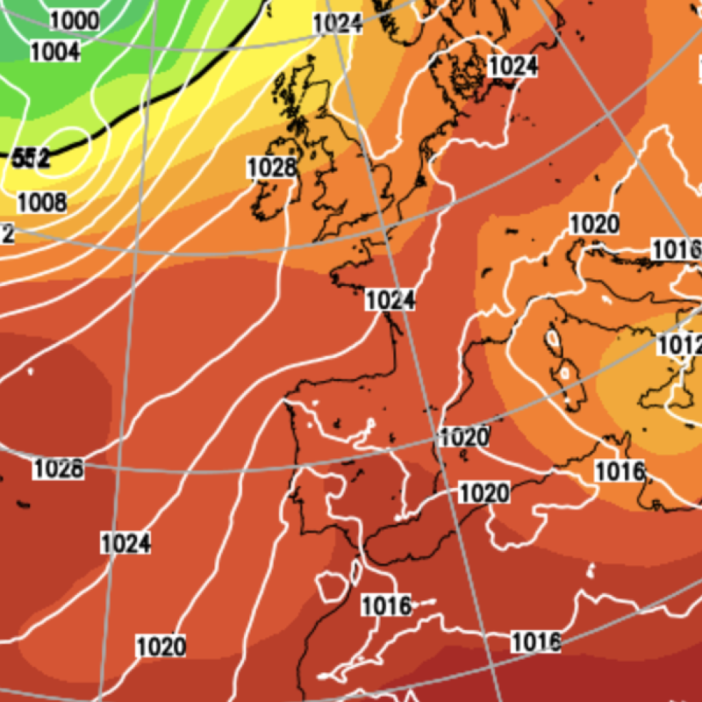
As October begins, high pressure to the northeast of the UK is forecast to become more influential on the weather.
Longer drier spells will be focused more across the north and northeast.
Occasional rain may tend to be more prevalent towards the south and west.
Despite the gloom, temperatures are expected to be above average overall.
Looking further ahead into mid-October and beyond, it may turn more widely unsettled, with a greater chance of wet and windy conditions at times.
Met Office Deputy Chief Forecaster Dan Holley outlined the forecast heading into this weekend.
LATEST DEVELOPMENTS:
Heavy rain and hail forecast as slow-moving weather system to hit parts of BritainWarm sunshine set to return to parts of UK in just days after cold spellHosepipe bans across Britain could stay in force until next spring despite weeks of rain
He said: “Once early fog patches clear in the south, Friday will be exceptionally warm for late September, especially in the southeast closest to an area of high pressure over the nearby Continent.
“A weakening cold front will drift gradually southeastwards overnight and into Saturday, with temperatures falling back closer to average over the weekend.
“This sets up a mixed weekend of weather, much of Saturday will be fine and dry before an increasing chance of rain or showers on Sunday, especially in more western parts.”
Looking ahead to next week, the expert highlighted the chance of wet and windy weather.
He added: “While details are naturally uncertain at this range, a particularly deep area of low pressure could pass close to the UK during the first half of next week.
“This may bring some wet and windy weather for some, which coupled with high spring tides could bring impacts to some coastal areas in the west.”
Our Standards: The GB News Editorial Charter