England and Wales are set to bask in an “unusually warm” start to October today with dry, warm and sunny conditions expected.
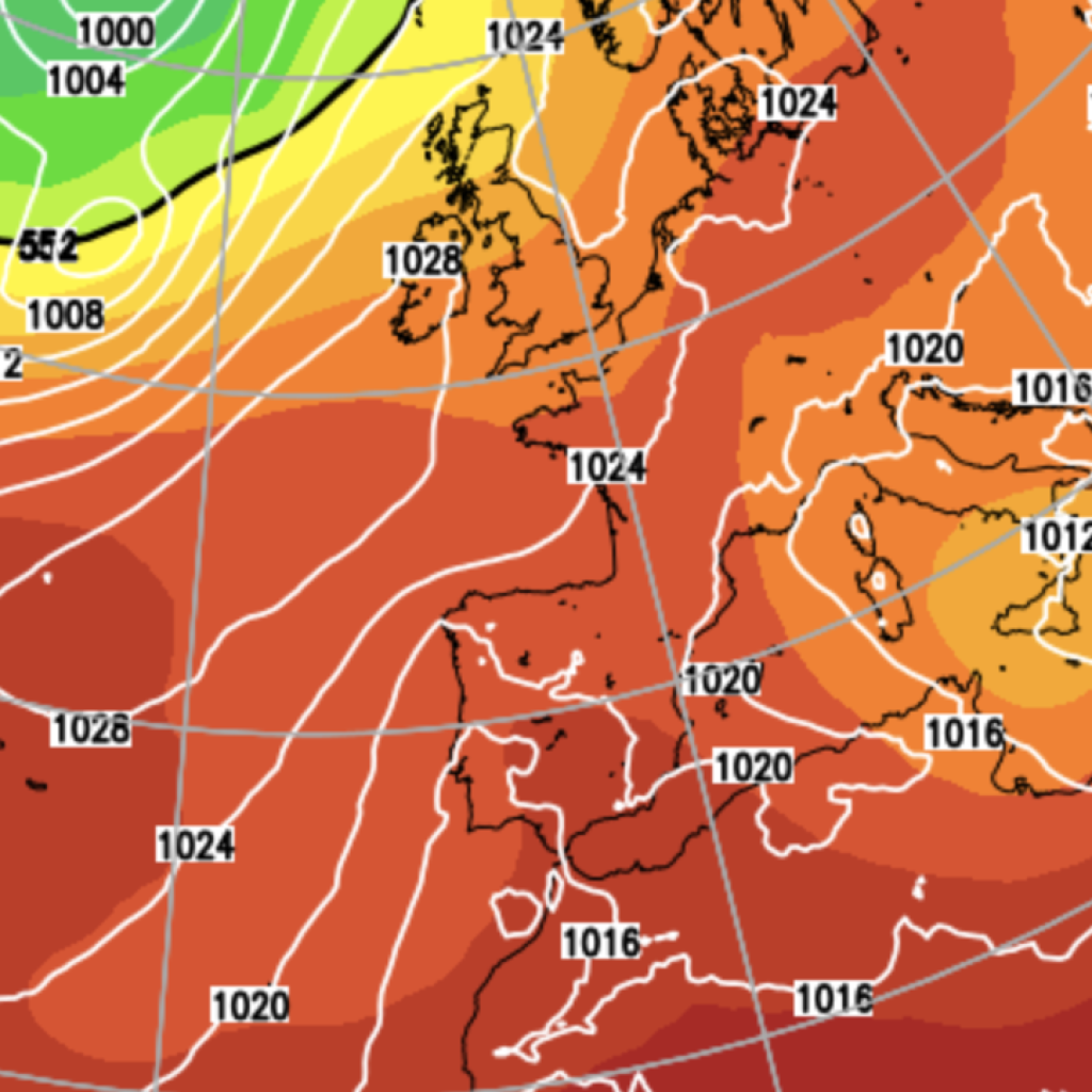
A block of high pressure is behind the weather pattern, with forecasters predicting temperatures could reach 20C on Tuesday.
Despite a few potential patches of fog first thing this morning, conditions are set to improve drastically across much of the south of the UK while northern areas are likely to be cloudier with possible outbreaks of rain.
Rain could be particularly heavy and persistent across parts of Scotland.
In a blog for NetWeather, Senior Forecaster Nick Finnis writes: “For those in southern UK, make the most of today, which will be sunny and unusually warm for early October across England and Wales, thanks to high pressure in charge, though watch out for fog in places first thing.
“Northern areas will be cloudier with outbreaks of rain across the northwest through to Tuesday, which will turn heavy and persistent at times across western Scotland.”
Speaking specifically about Tuesday, he adds: “On Tuesday, generally cloudy across southwest England, Wales and northern England, with a band of patchy rain along a cold front slow-moving through much of the day across northern England and north Wales. Brighter conditions feeding in from the northwest across Scotland and Northern Ireland, though with showers toward western and northern coasts.
“Still warm and sunny across southeast England and East Anglia, with temperatures reaching the low 20s again.”
From Wednesday, conditions are likely to deteriorate, with much of the UK needing an umbrella.
As a cold front moves southwest, rain will likely develop widely across both England and Wales.
Showers will also develop across Scotland as temperatures drop sharply in the cold front.
However, the rain across England should clear by the evening.
LATEST DEVELOPMENTS:
Two migrant men killed attempting to cross English Channel in small boatBT to buy TalkTalk in major rescue deal after broadband giant enters administrationUK fuel supplies risk ‘severe disruption’ as North Sea oil workers prepare to strike
In its wake, overnight temperatures will be markedly chilly but Thursday should feel drier and cooler.
Looking further ahead Mr Finnis said: “From Friday through to Sunday, a generally more unsettled picture across the UK looks likely, with rain and showers spreading in from the west, heavy at times in the northwest and with stronger winds.
“An Atlantic frontal system looks to bring outbreaks of rain across most areas on Friday, perhaps drier in the south on Saturday and Sunday, sunshine and blustery showers in the north, merging into a longer spell of rain later on Sunday.”
The Met Office long range forecast from that same Friday predicts: “It will be a changeable period as weather systems move in from the Atlantic, bringing spells of rain or showers to most areas.
“There will be heavy at times, especially in the northwest, with some strong winds.
“There will still be some drier and brighter interludes between systems, especially in parts of the south and east.
“Temperatures will likely be near to normal at first, perhaps becoming warmer later.”
Our Standards:
The GB News Editorial Charter