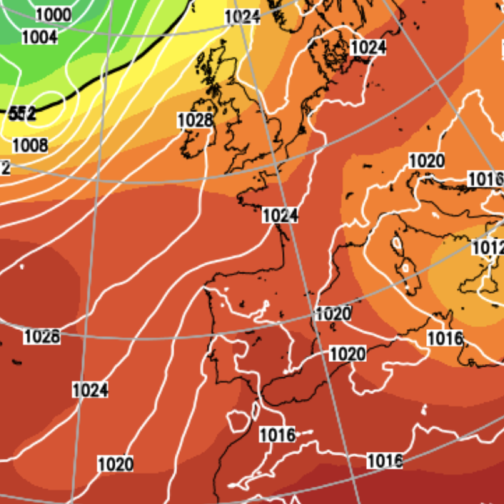
Forecasters have warned Britons that a system of “high pressure” will bring “dense and stubborn” fog across the country.
The Met Office has said we are now “saying goodbye to the low pressure and saying hello again to high pressure” following two storms.
After Storm Austen and Storm Boelo wreaked havoc across the country, the forecast is set to change over the next 48 hours.
Met Office forecaster Craig Snell said: “We’re saying goodbye to the low pressure and saying hello again to high pressure.
“Come Thursday morning, some parts of the south and central parts of the UK could wake up to some fairly dense fog patches.
“They will be quite slow to clear. We’re entering that time of year where fog can be quite stubborn to move once it’s formed.”
The transition into drier but foggier conditions follows the tragic deaths of three people due to the extreme weather conditions brought on by Storm Boelo.
Two men and one woman died as a result, with both men being hit by falling trees and the woman being swept out to sea as she was walking her dog.
Mr Snell said although many of us have “certainly seen some very wet and windy weather” with the two named storms, next weekend is expected to be “very different” to the last.
He added that the main risk of any disruption over the next five days would be from “dense fog patches rather than wind and rain”.
Storm Boelo alone produced gusts of up to 84mph, with at least 160,000 homes across the country left without power as a result.
The two named storms also caused havoc for the country’s transport networks, with more than 1,500 flights at airports including Heathrow, Manchester, Edinburgh and Glasgow delayed.
LATEST DEVELOPMENTS
Met Office warns ‘significant snowfall’ will remain part of Britain’s weather as Polar vortex loomsWeather warnings remain in place after weekend of widespread disruption caused by stormsMan who died after being hit by falling tree in Storm Boelo named as world-renowned royal gardener
Rail services were also severely restricted, with torrential rain and fierce gusts shutting down Blackpool’s tram network.
The Met Office’s amber warning for Storm Boelo expired at 9pm on Sunday evening, but meteorologists have warned that brutal wet and windy weather will continue this week.
Issuing a yellow weather warning for much of the west coast of the UK, the forecasters cautioned that a spell of strong south to south-westerly winds may cause some disruption.
The Met Office said: “A breezy day today with a mixture of cloud and scattered showers. Showers will be most frequent in the north and west, with the best of the brightness towards the southeast. Mild for all.
“Tonight, mostly dry overnight with clear spells, though a few showers in the west. Mist and fog developing across central and southern England, where it will also turn chilly.
“On Thursday, a mainly dry day with a mix of cloud and sunny spells, after the clearance of morning fog and low cloud from southern and central England. Temperatures near average.
“The outlook for Friday to Sunday shows rain will move into northern and western areas for a time during Friday and Saturday. Otherwise largely dry and settled with variable amounts of cloud and some night-time fog.”
Much of England and Wales is forecast to remain dry into the beginning of November, although weather fronts may still bring rain to Scotland and Northern Ireland, forecasters say.
Our Standards:
The GB News Editorial Charter