Britain is set for a spell of unseasonably warm weather today, with temperatures potentially reaching 26C in parts of the country.
The highest temperatures are expected in south-east England, where readings could climb into the mid-20s.
Much of England is likely to see temperatures above 20C, while Wales, Scotland and Northern Ireland could reach the high teens or low 20s.
Overall, temperatures are expected to be around 3C to 7C higher than the seasonal average.
The warmth will persist into this evening, with some areas potentially remaining close to 20C as night draws in.
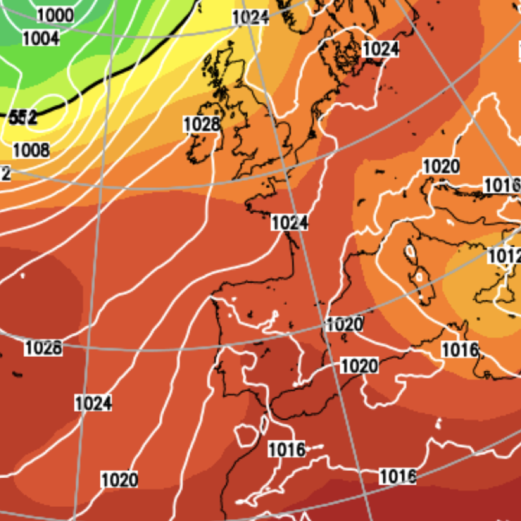
The unusual conditions are being driven by a strengthening southerly airflow, which will transport very warm air northwards from continental Europe.
Met Office Chief Forecaster Matthew Lehnert said: “A deep area of low pressure far into the Atlantic is the primary driver behind the UK’s weather over the next few days.
“Its first influence will help pull some warmer air over much of the country on Tuesday, notably warm for the time of year. A warm night will follow across southern and eastern areas, with minimum temperatures of 19°C in places.”
France and Spain have experienced temperatures above 30C in recent days and some of that heat will be carried towards the UK by the southerly winds.
At this time of September, typical daytime temperatures in England are generally between 16C and 19C.
This morning begins with extensive cloud and a few showers, but brighter conditions are expected to develop later, particularly across England and Wales.
Wales, Northern Ireland and Scotland will also experience temperatures above their seasonal averages, with maximum temperatures of around 17C to 22C. Some areas may start the day with sunshine before cloud gradually spreads in.
LATEST DEVELOPMENTS
Iconic London bridge could be forced to shut down within three years after cracks foundM25 traffic: Drivers face TWO HOURS of delays near Dartford Crossing after huge lorry fireBBC demands dedicated button on TV remotes so audiences ‘stay connected to British values’
Winds will strengthen as the day progresses, particularly across Northern Ireland and western Scotland, where gusts could reach 50mph.
Influence of low pressure moving north-eastwards across the Atlantic towards Iceland will help maintain the southerly airflow overnight and into Wednesday, keeping temperatures unusually high.
Overnight lows are expected to remain between 15C and 19C across much of the UK — levels more commonly associated with a summer night than the end of September.
In south-east England, temperatures could potentially stay at or above 20C throughout the night.
Normally, overnight temperatures in late September are around 7C to 11C, highlighting just how exceptional the warmth will be.
The latest spell comes as September looks set to continue the UK’s broader run of above-average temperatures.
As of last Saturday, the Central England Temperature (CET) record — the world’s longest-running temperature series, based on observations from several locations in England — was 2.6C above the long-term average.
Every month so far in 2026 has recorded a mean CET above its historical average, with the year-to-date figure also standing 2.6C above normal.
For 2026 not to rank among the UK’s warmest years on record, temperatures would need to be significantly below average for the remainder of the year.
The Met Office’s latest three-month outlook, covering October through December, also indicates an increased likelihood of milder-than-average conditions continuing into autumn and the beginning of winter.
Our Standards: The GB News Editorial Charter