Britain is set for a milder-than-expected start to October with temperatures forecast to be “warmer than average”, as high pressure builds across the country.
Following a September characterised by a blend of rainfall, gusty winds and occasional sunshine, BBC Weather forecasters suggest the pattern of above-normal temperatures will persist into the new month.
Forecasters noted that a rain band cleared eastwards yesterday, making way for a combination of bright spells and scattered showers today as winds subside.
While conditions will feel slightly cooler, temperatures are still expected to sit “a little above, or at least close to, the seasonal average.”
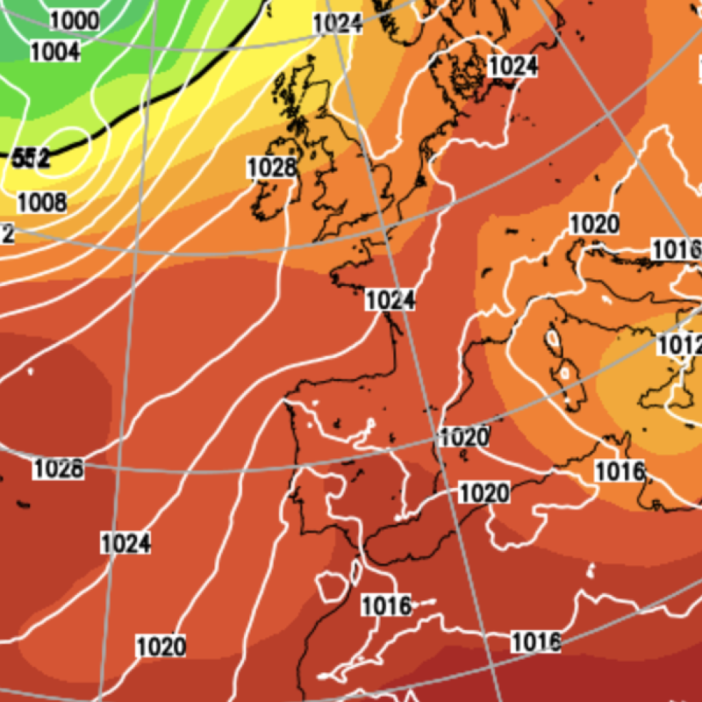
The longer-term picture points to high pressure taking a firmer grip next week, ushering in a spell of drier, settled weather for most areas.
Heading into the weekend, a spell of more widespread rainfall is forecast to sweep in from the west on Friday, accompanied by strengthening winds.
A ridge of high pressure sitting to the south could, however, shield southern and eastern parts of England from the worst of it.
By Saturday and Sunday, that high pressure system looks set to extend further, delivering calmer and drier conditions across much of England and Wales.
Scotland and Northern Ireland face a less settled picture, with gusty winds and bouts of showery rain likely to return by Sunday, particularly across northern and western areas.
For England and Wales, overnight and early morning mist or fog patches are possible as nighttime temperatures dip, though afternoon readings should remain “near to a little above normal,” according to BBC Weather.
The Met Office’s own long-range forecast paints a broadly similar picture.
The national weather service expects high pressure to settle over the southern half of the UK during the opening days of this period, delivering “plenty of dry weather,” albeit with cold nights and patches of fog forming overnight and into the mornings.
LATEST DEVELOPMENTS
Britain set for ‘weather bomb’ as Atlantic storm to brew-gale force winds in just 24 hoursUK weather: Temperatures reaching 26C across Britain in unusually warm autumn burstUK weather: Britain to bathe in late September warmth before rain and wind return in days
Further north, conditions will remain more unsettled, with spells of rain and blustery winds arriving at intervals.
The Met Office anticipates that changeable patterns will extend through to the middle of the month, as ridges of high pressure push in from the south-west only to be interrupted by Atlantic frontal systems.
Some of these could bring “quite deep and fast-moving depressions,” raising the prospect of windier weather, most probably affecting northern and eastern regions.
Temperatures are forecast to stay “near or slightly above normal overall.”
The second half of October remains harder to pin down, with the Met Office describing it as “quite an uncertain period.”
Earlier signals pointing to conditions being significantly wetter than usual now appear less probable.
Instead, a broadly changeable pattern is expected to hold, with the heaviest and most blustery weather concentrated in western and north-western areas, while the south and east should stay comparatively drier.
A predominantly westerly airflow is considered the most likely scenario, which would keep temperatures “close to or a little above average overall.”
The Met Office has cautioned, however, that slower-evolving weather systems could develop, potentially producing either extended dry spells across wider areas or allowing rainfall to build up in parts of the country that are typically drier.
Beyond the immediate forecast, the Met Office has warned of a “heightened potential” for wet, windy and stormy conditions this autumn, along with an increased flood risk.
The period from October to December has double the usual probability of being wet overall, with mild and blustery weather also more likely than normal.
Dr Will Lang, the Met Office’s chief forecaster, described it as a “subtle shift in the odds,” adding: “We are going in with a heightened potential for wet weather, heightened potential for potentially stormy conditions, and that leads through to a heightened potential for flooding.”
Our Standards:
The GB News Editorial Charter